
JMap Image Analysis
Available for JMap Server starting from version Kathmandu HF7
Licence required
Compatible with:

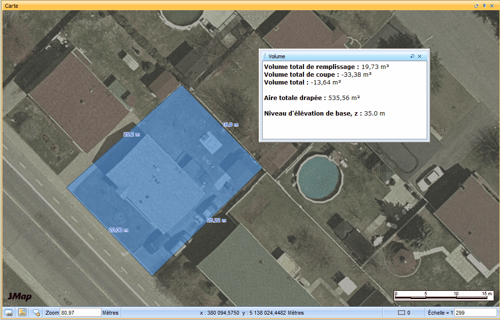
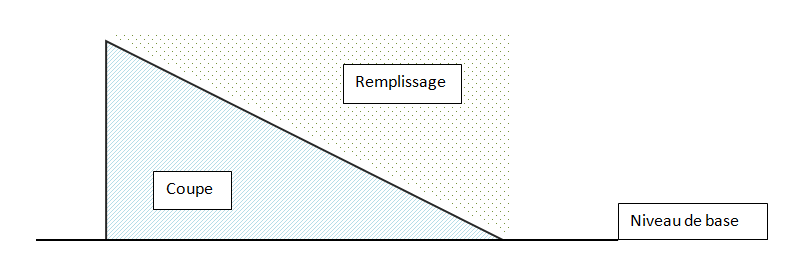
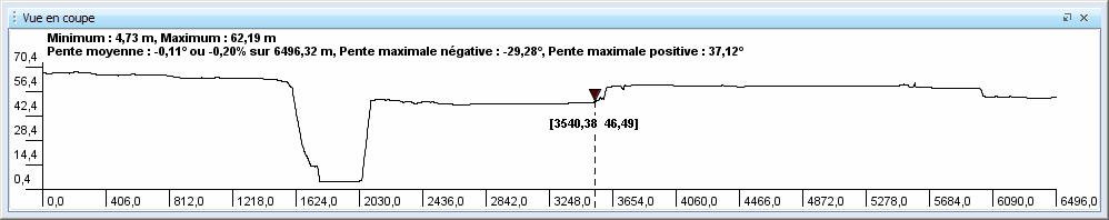
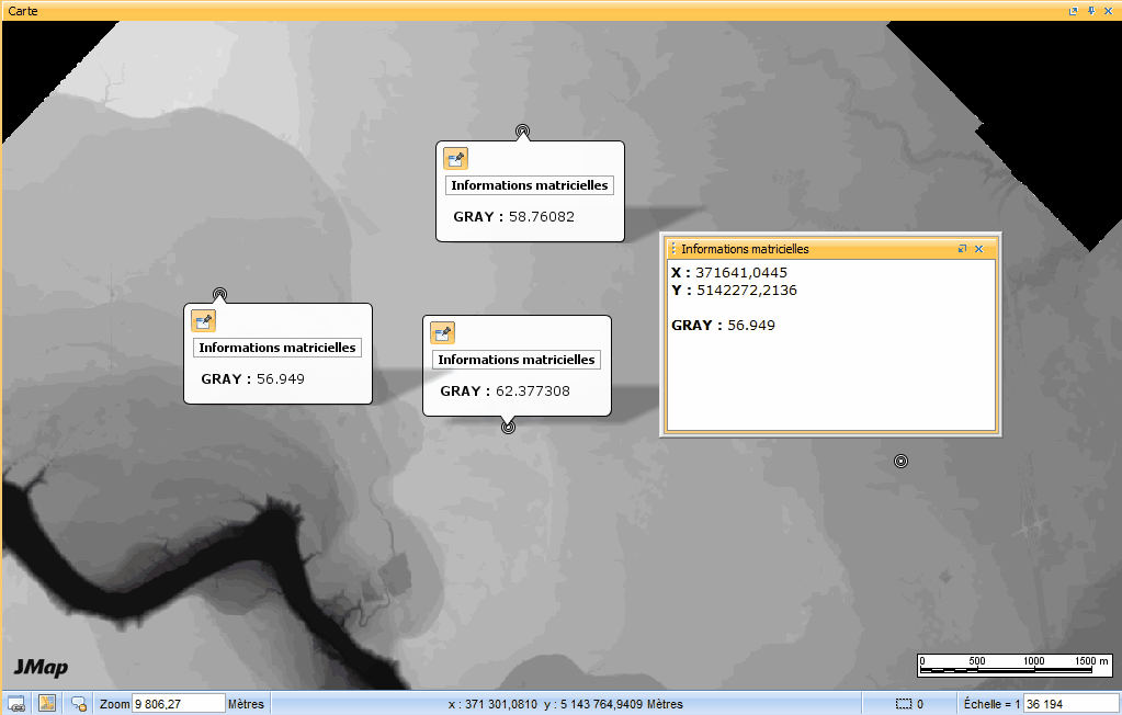
The JMap Image Analysis extension provides users of the JMap Pro application with advanced interaction with spatial raster data sources, particularly digital terrain models (DTMs). With Image Analysis, users can fully leverage DTMs for various calculations. This extension utilizes the elevation band value (often referred to as GRIS) to perform elevation-related calculations. Among its functionalities, it allows users to obtain elevation at any point, visualize profiles (cross-sectional view) between two points, calculate slopes between two points, determine a line of sight around a point, and calculate cut and fill volumes within a polygon, among others.
No items found.