
JMap Tracking
Available for JMap Server starting from version Kathmandu HF13
Licence required
Compatible with:

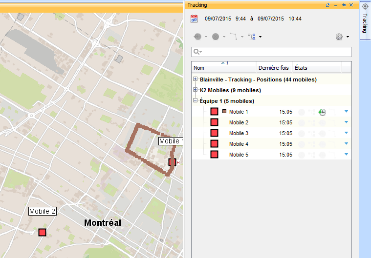
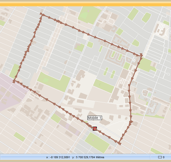
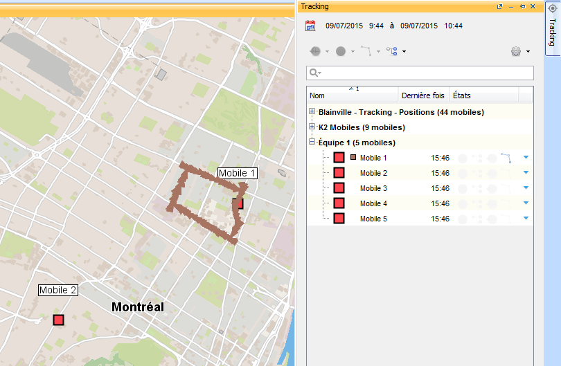
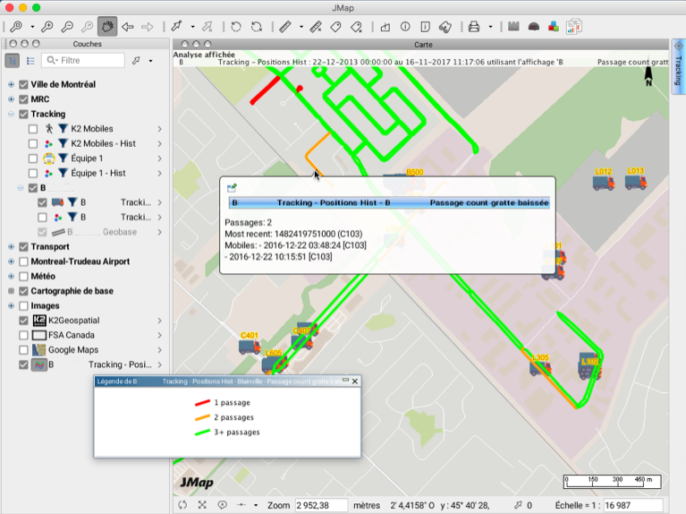
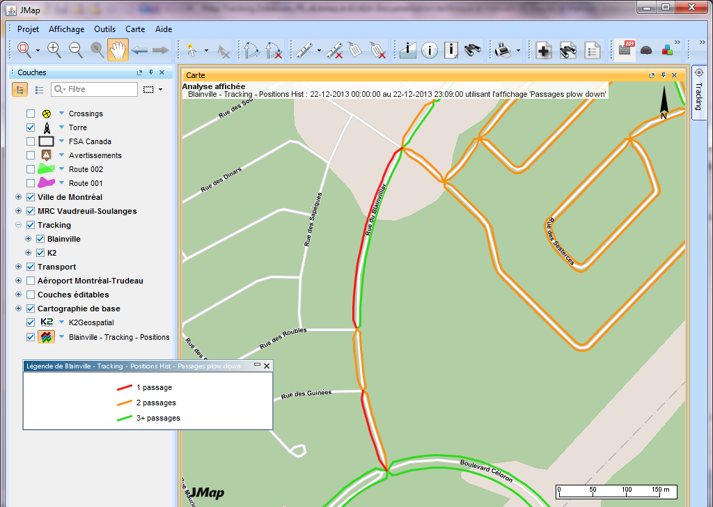
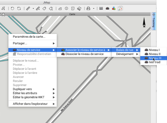
The Tracking extension is designed to manage mobile units such as people, vehicles, and equipment in JMap Pro applications. It offers various features, including real-time tracking of mobile object activity. Tracking also includes telemetry data such as the geolocation of a snowplow, the position of a truck's snow shovel, or the spreading of salt by a vehicle. Users can analyze this data with map support to visualize movements and activities over a user-defined period. Geo-fencing of mobile units can be conducted to send alerts when a rule is violated. Additionally, reports on analyses and mobile unit characteristics can be generated and exported in various formats.
.png)
No items found.